Exploring Guatemala means crossing a country where nature, culture, and heritage respond to one another from one region to the next. From the northern jungles and their major archaeological sites to the rivers and mangroves of the inland Caribbean, passing through volcanoes, highland lakes, and Pacific beaches, each route offers a different way to enter the country.
The guide Travel through Guatemala’s Protected Areas, developed by the Guatemalan Tourism Institute (INGUAT) and the National Council of Protected Areas (CONAP), brings together five itineraries that combine iconic locations with lesser-known sites, sometimes reached after several hours of hiking.
Mundo Maya Route
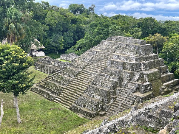
In the north, in Petén, the forest stretches to the horizon. At Tikal, temples rise above the canopy, while trails cross the Maya Biosphere Reserve in an atmosphere where archaeological remains and wildlife coexist.
The Maya city of Aguateca, perched on the Petexbatún escarpment, offers another way to understand this region. Its 700 structures — including 11 restored — reveal a stone bridge spanning a natural fault and traces of a sudden abandonment. From the promontory, the river and the Petexbatún lagoon stretch below, showing how the terrain formed an integral part of the pre-Columbian city’s defensive system.
Green Caribbean & Eastern Route
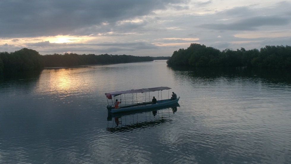
To the east, the Río Dulce connects the country’s interior to the Gulf of Honduras. The river flows through mangroves, tropical forests, and wetlands, shaping a landscape where water organizes movement.
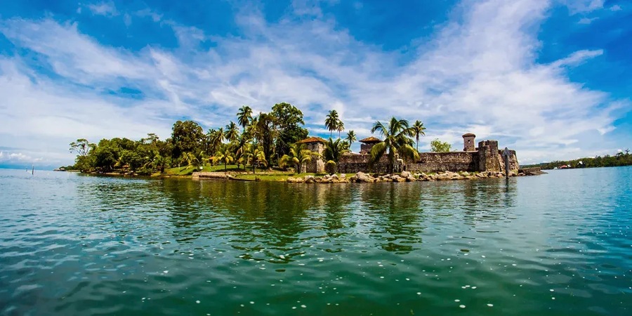
At the protected site of Chocón Machacas, wetlands and riverside forests shelter the West Indian manatee and a wide range of wildlife. Following the river downstream leads to the Castillo de San Felipe de Lara and the canyon, before arriving in Livingston, a Garífuna town where music and cuisine reflect a living Afro-Caribbean heritage.
Boat trips, kayaking, or walking trails allow visitors to observe howler monkeys and tropical birds in an environment where biodiversity remains visible and accessible.
Jungle Adventure Route
In the Verapaces, water shapes the landscape. Caves, underground rivers, and natural pools form a dense and humid setting. The protected site Mario Dary Rivera Biotope offers the chance to glimpse the quetzal in its natural habitat.
The Lanquín Caves and Semuc Champey, with their turquoise pools and rock formations, show how the river has shaped the terrain over time. Hiking and nature observation take place in a landscape that remains largely preserved.
This region also has one of the highest concentrations of Indigenous populations in the country. The Q’eqchi’, Poqomchi’, and Achi maintain practices such as weaving, pottery, coffee cultivation, and ceremonies like Rabin Ajaw, which honors young women committed to cultural transmission.
Volcano, Landscape & Culture Route
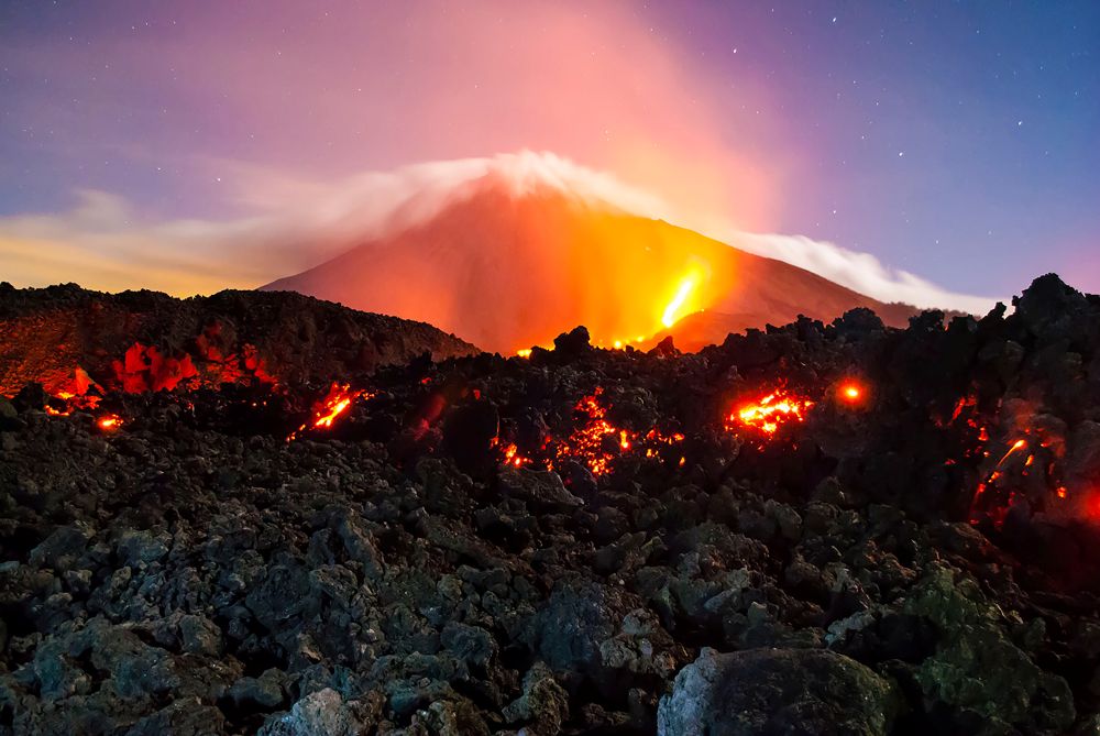
In the highlands, volcanoes dominate the landscape. Climbing Pacaya Volcano allows close observation of recent activity, with clear-day views extending to Antigua Guatemala.
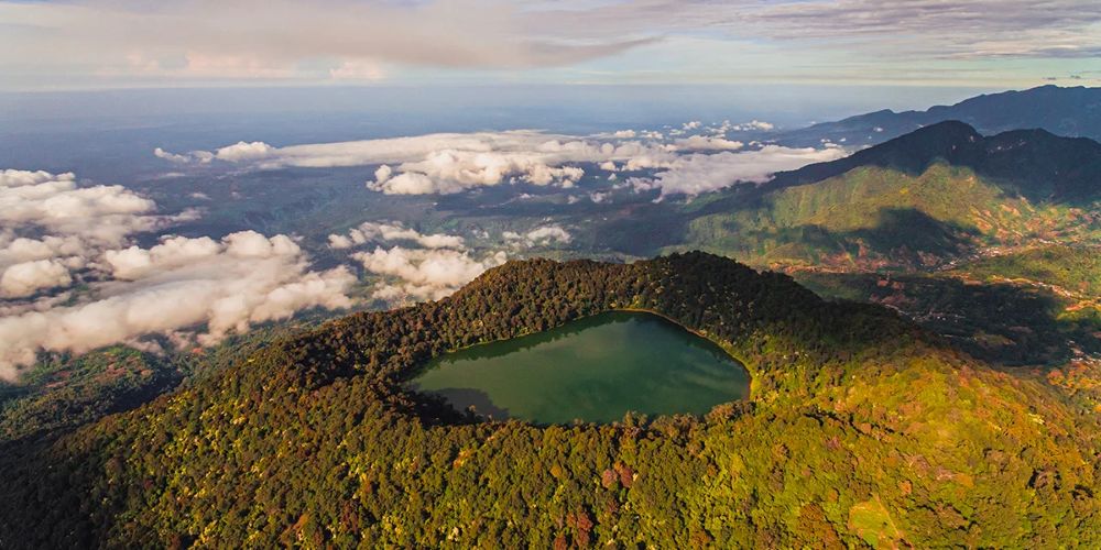
Further west, Chicabal Volcano shelters a crater lake surrounded by forest. The site holds spiritual importance for Maya communities, who still conduct ceremonies there. The gradual and silent ascent leads to a space that is both natural and symbolic.
Our article: Antigua: An enchanting journey through Guatemalan history and culture
Mountains & Beaches Route
On the Pacific coast, the beaches of Sipacate-Naranjo National Park and Poza del Nance host annual nesting of green and olive ridley sea turtles. Consistent waves have also made this area a meeting point for surf enthusiasts.
Farther south, the private reserve Los Tarrales Reserve extends across wooded hills. Shaded trails and viewpoints reveal the landscape from the highlands to the shoreline, following the transition between upland forests and coastal plains.
You may also like: Surfing in Latin America: 6 spots to ride all year round
Across these five itineraries, Guatemala reveals itself in continuity: forest, river, volcano, mangrove, and ocean are not isolated fragments but components of a single whole. Each region offers a different gateway into the country and hints at a diversity that cannot be exhausted in a single journey.
Photos: Visit Centroamérica | Municipalidad de sipacate