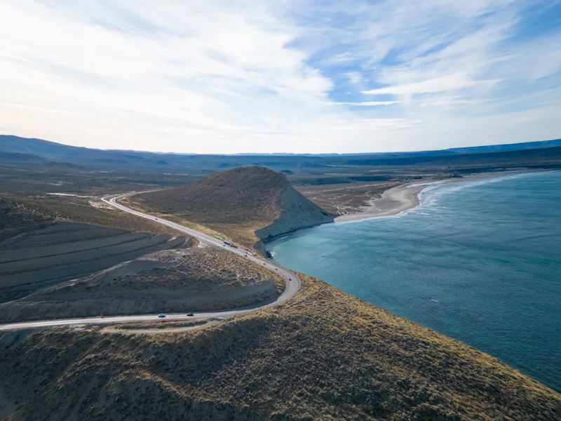
In Argentina, some roads are about much more than the route they follow. Ruta Nacional 3 is one of them. It starts in Buenos Aires, heads down toward the Atlantic coast, crosses the pampas, reaches Patagonia, passes port cities, cliffs, beaches and windswept plains, before ending in Tierra del Fuego, at the gateway to Tierra del Fuego National Park.
Over more than 3,000 kilometers, it connects the centre of the country with Ushuaia and Bahía Lapataia, at the end of the continent. The road crosses five provinces: Buenos Aires, Río Negro, Chubut, Santa Cruz and Tierra del Fuego. Less internationally known than Ruta 40, which is more closely associated with the Andes, it tells the story of another Argentina: one of the Atlantic, the steppe, ports, marine wildlife and vast open spaces.
Officially presented during FIT 2026 in Buenos Aires, the National Route 3 Tourism Guide marks a new stage in promoting this route. Produced by the Automóvil Club Argentino in coordination with the Secretariat of Tourism, Environment and Sports, as well as the provinces and municipalities along the route, it lists experiences, towns, landscapes and points of interest throughout the journey. It is a way of looking at Route 3 not simply as a road heading south, but as a tourism itinerary in its own right.
From Buenos Aires to the first great distances
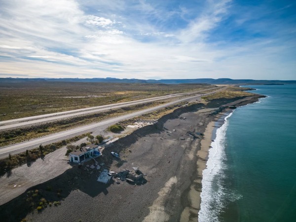
Leaving Buenos Aires on Route 3 means first crossing a more discreet Argentina. The first stages run through the province of Buenos Aires, between plains, roadside towns and rural landscapes. Azul is one of the interesting stops, with its heritage linked to architect Francisco Salamone, its monumental buildings from the 1930s and its nearby sierras.
Further south, the road takes us to Carmen de Patagones, one of the region’s historic towns. On the other side of the Río Negro, Viedma already marks a change of atmosphere. Patagonia often begins like this: without a spectacular break, but with a wider sky, a stronger wind and a growing sense of space.
Las Grutas and the first images of the Patagonian Atlantic
In the province of Río Negro, Las Grutas marks one of the first major seaside stops along the route. The resort is known for its cliffs, beaches and pronounced tides. At low tide, the landscape changes completely: the water recedes, rocks appear, beaches widen and natural pools sometimes retain the warmth of the sun.
Around the Golfo San Matías, the road begins to reveal what will make it distinctive further south: the meeting of steppe and ocean. This is not yet Patagonia at its most isolated, but it is already an open, rocky coast, with possible detours toward Punta Perdices, the Salinas del Gualicho or areas for observing marine wildlife.
Puerto Madryn, Península Valdés and Punta Tombo
Upon entering Chubut, Ruta 3 approaches one of Argentina’s major marine wildlife areas. Puerto Madryn is often the most practical base for exploring the region. The city opens onto Golfo Nuevo, beaches, boat excursions, snorkeling with sea lions and trips to Península Valdés.
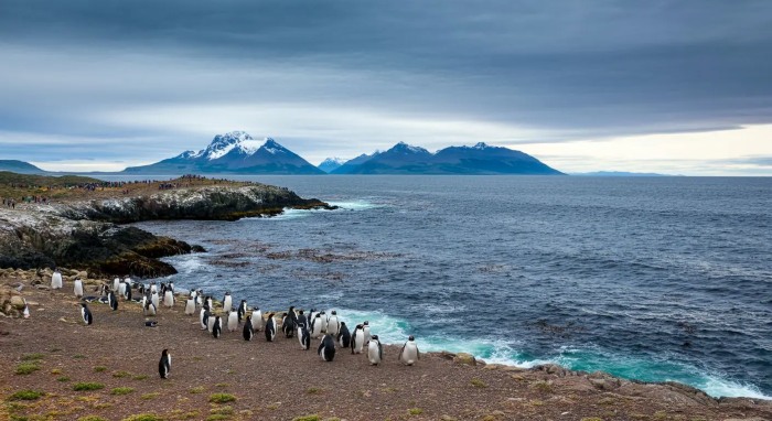
Listed as a UNESCO World Heritage Site, Península Valdés remains one of the great natural sanctuaries of the Atlantic coast. Southern right whales, orcas, sea lions, elephant seals, Magellanic penguins and seabirds make up a living landscape that changes with the seasons. Further south, Punta Tombo offers the chance to approach one of the largest mainland colonies of Magellanic penguins.
In this part of the journey, Route 3 is not always the road closest to the coast. It is often necessary to leave the main route to reach reserves, villages or headlands extending into the Atlantic. That is also part of its appeal: the road sets the direction, but some of the best stops require a detour.
Between steppe, ports and small southern towns
After Trelew and its major paleontology museum, the road settles back into its rhythm. The straight sections grow longer, the vegetation becomes lower and the distances between towns become more noticeable.
This part of the journey is less well known than Península Valdés or Ushuaia, but it gives Ruta 3 much of its character. At times, the steppe almost reaches the sea, with cliffs dropping into the Atlantic. The wind accompanies the drive. Port towns recall the history of oil, fishing, livestock farming and the major migrations that shaped Patagonia.
Puerto San Julián deserves a stop for its connection with maritime history. Here, the memory of Magellan’s expedition is preserved through a replica of his ship, the Nao Victoria, as well as museums dedicated to pioneers, rural life and the region’s cultures. The itinerary takes on a more historical dimension: it does not simply run alongside landscapes, but also crosses ports and stories of navigation.
Find out more: Patagonia Azul, another way to explore Argentina’s coast
To Tierra del Fuego
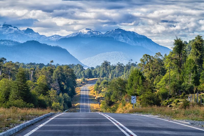
Further south, the road reaches Río Gallegos before beginning the most unusual stage of the journey. To reach Tierra del Fuego by road, it is necessary to pass through Chile, cross the Strait of Magellan by ferry, then re-enter Argentina through the San Sebastián sector. This detour is a reminder that southern geography imposes its own rules: here, the road alone is not always enough, and borders, winds, ferries and schedules also have to be taken into account.
Once in Tierra del Fuego, the landscape changes again. The steppe gradually gives way to forests, mountains, lakes and the more enclosed relief of the far south. Río Grande marks an important first stop before continuing toward Ushuaia. The road then approaches the Beagle Channel and Tierra del Fuego National Park.
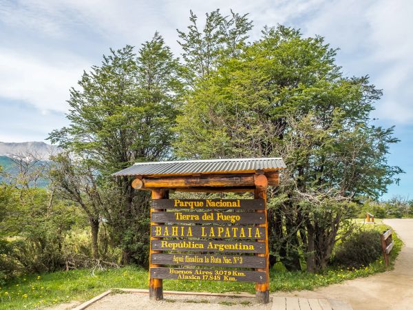
At Bahía Lapataia, inside the national park, the journey reaches its final point. The place is often photographed for its end-of-the-road sign, but its appeal goes beyond the symbol. After thousands of kilometers of plains, ports, cliffs and steppe, the arrival takes place in a landscape of southern forest, cold water and low mountains. The journey does not end in a large city, but in a natural setting where the road simply stops.
Our article: Ushuaia: an odyssey at the threshold of the unknown world
A route to experience in stages
Ruta Nacional 3 is not travelled as a simple transfer between Buenos Aires and Ushuaia. Distances are long, services can be far apart and weather conditions can change quickly, especially in Patagonia. The stages, accommodation, crossings and documents required to travel through Chile toward Tierra del Fuego all need to be planned.
Driving it from end to end is a real expedition, but that is not the only way to experience it. The road can also be explored in sections, as part of a wider trip: a few days around Península Valdés, a stretch between Río Negro and Chubut, or a final southern section toward Ushuaia.
For travelers, it is another way of reading Argentina. Less vertical than Ruta 40, and less immediately spectacular in some sections, it advances with the sea, the distances and life in the south. Its appeal also lies in what appears between two stops: an empty beach, a gas-station café, a cliff above the Atlantic, a changing sky, a wind that never seems to stop.
Photos: Visit Argentina | Fredi Carrera